From Kawah Ijen to Mount Bromo
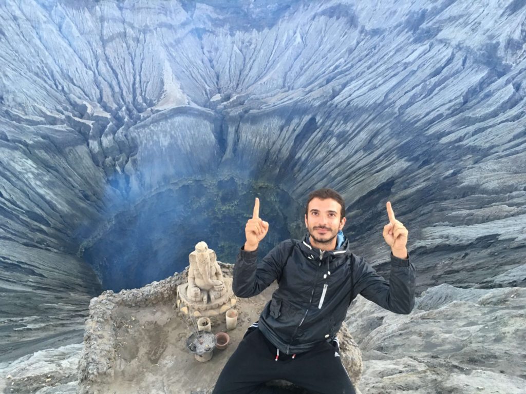
After my first-ever nightly hike chasing the blue fire at Kawah Ijen, I felt like I wanted to check yet another incredible volcano. As you might remember, Kawah Ijen is kind of close to Banyuwangi. Mount Bromo is within the town of Cemorolawang. Thus, the first step towards hiking to Mount Bromo on your own would be finding out how to get to Cemorolawang. In my case, it looked something like this:
I didn’t have a car so I started to look for public transport to make it from Banyuwangi to Probolinggo. One of the guys working at Mango Tree Guesthouse gave me a ride to Banyuwangi’s train station. It was then that I bought my train ticket to Probolinggo. I paid 29 K and the train was comfortable and had aircon. It was also then and there that I met three girls: one from Israel, one from Chile and one from the Basque Country (Spain). As the train arrived and we started to look for our coaches, we found out we were sitting together. Ahead of us we had four hours of train, so I felt happy about having someone to speak to 😉
It turned out that Conti (the girl from Chile) and Mai (the girl from Spain) had met in Port Douglas (Australia). As soon as they told me that plenty of memories came from my time looking for work in Cairns and its surroundings. They had spent around a year in Australia with the Work & Holiday Visa and they were now travelling around Southeast Asia for a while. Out of the blue I had just met two people with whom I shared more than a train ride to Probolinggo.
I spent the four hours switching between talking to my new friends, reading and trying to catch some sleep. The landscape was pretty much flat throughout the whole ride. There were plenty of rice fields, palm trees, rivers, towns and some small mountains. After 11 days in Indonesia I kind of new a little bit that landscape 🙂
Spending the night in Probolinggo
We arrived at Probolinggo’s train station at around 18:00. During the trip I told the girls I was on my way to Mount Bromo. They were too. I had done some research and found out that, once at Probolinggo’s train station, we needed to make it to Bayuangga Terminal (Probolinggo’s bus terminal). To that extend, there would be some small yellow buses that would take you there for around 5 K. Apparently some touts would try to scam you. They would tell you that the buses are not going to Bayuangga Terminal. I also read that some would tell you, as you are approaching the terminal, that the are no longer buses to Cemorolawang and you might go to their office so they can find you a private mini van.
In our case, we didn’t find any yellow buses. It might be that it was kind of late already. We hired a Grab and we made it to Bayuangga Terminal. Once there, we tried to find a bus going to Cemorolawang without success. There were some mini vans outside the terminal. We tried to bargain with some of them but they were asking too much. A mini van can host up to 15 people. The price of the mini van is 525 K. If the mini van is full you pay 35 K per person. There were not many people except us waiting for the mini van so we had to pay way more than that. As we bargained, we started to look for a place to spend the night in Cemorolawang. There were none.
Cemorolawang is not a very touristic city. So, there are accommodation options not advertised on the Internet. It could be that once there we found something or it could be the opposite. After pondering our options for a while we decided to stay in Probolinggo and look for a place to spend the night.
We didn’t find many options available in Probolinggo. The city, while being bigger than Cemorolawang, it is not a touristic one either. We found two or three places. They were kind of far away from one another. Thus, after having dinner (there are some bars/restaurants around the bus terminal), we decided to walk to Hotel Moronyoto, the worst quality-price hotel I have ever made it to.
The hotel was like the typical motel you see in the movies. Both the outside and the inside. I paid 100 K for a private room whose bed was disgusting and whose quality was far from good. It’s not like I’ve been sleeping in palaces but that was another level. The people working there were also similar to the hotel. After 100 K for the room they told us we needed to pay for toilet paper. Crazy.
Thus, if you can, try to find accommodation beforehand so you can make it to Cemorolawang and have a place to sleep. If you can’t and you have to spend the night in Probolinggo, please, don’t go to Hotel Moronyoto. You will thank me later.
From Probolinggo to Cemorolawang
We woke up kind of early the next morning and, after having breakfast, we went back to the outside of the bus terminal. There were some people already waiting to fill a mini van. We were not in a hurry so we decided to wait until the mini van was full. Like that, we would pay 35 K each for the ride.
After an hour or so the mini van was finally full. We jumped inside and got ready for the drive to Cemorolawang. The drive took around 2 hours. The beginning of the path was fine. Later, however, it started to become narrower and full of curves. There were also some parts under construction. We saw the typical landscape and some small villages with children outside the school waving at us as we were passing by.
When we were like 30 minutes away from our destination, the landscape started to change dramatically. All of a sudden we found ourselves surrounded by impressive cliffs. I guess in a way it was no surprise since Cemorolawang is at 2217 meters over the level of the sea 🙂
Avoid the entrance fee in Cemorolawang!
While we were travelling to Cemorolawang we spoke with a German family. They told us they had booked a place and they had some spare beds. Since we hadn’t booked any accommodation yet, we decided to go with them to check out the place. Thus, as soon as we arrived to Cemorolawang, we got off the mini van and started walking with them.
As we were approaching the accommodation, some guard-looking guys approached us. They told us we had to pay the National Park fee. We didn’t understand anything. None of us had read anywhere that we had to pay a fee to see Mount Bromo. We thought they were trying to scam us. We argued with them for a while and then the German guy went to the hostel to ask about that. The guards were right… in a way.
HEADS UP! So, the thing is, if your hostel is within the National Park range, you do have to pay the entrance fee. If it is not, you don’t have to pay the fee. The entrance fee to Bromo Tengger Semeru National Park is Rp 217,500 for foreigners and Rp 27,500 for Indonesians in weekdays, and Rp 317,500 and Rp 32,500 respectively in non-weekdays (Feb 2018).
Thus, before booking your accommodation, ask the people in charge and find out whether their place is within the National Park or not. After finding out the accommodation the German family had booked was subject to a fee, we decided to avoid it and look for another one. They did the same.
Everything was either booked or super expensive on the Internet. So, we decided to go for a walk and try to find a place to spent the night offline. I don’t remember the name of the place. I believe it didn’t really have a name lol. All in all, we found a somehow good enough deal. We booked two rooms (we were four people) and we paid 75 K each. It was a homestay and it was way better than Hotel Moronyoto 😉
About Mount Bromo
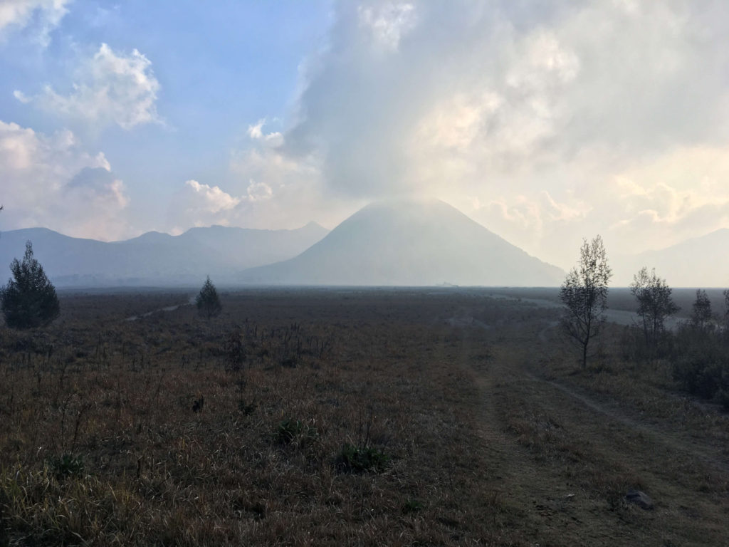
Mount Bromo (Gunung Bromo in Indonesian) is an active volcano, part of the Tengger massif, in East Java. While it is not the highest (2329 masl) of the volcanoes within the massif, it is the most well-known. The massif is an active volcano complex surrounded by what is known as the “Tengger Sand Sea”. The whole area (aka the Bromo Tengger Semeru National Park) is one of the most visited places in East Java.
The current volcano complex was formed after the eruption of the ancient Tengger volcano. The eruption led to a new huge caldera and five new volcanoes: Mount Bromo, Mount Batok, Mount Kursi, Mount Watangan and Mount Widodaren. Mount Batok is the only one inactive and Mount Semeru, just outside the caldera, is the highest (3676 masl) mountain on the island of Java.
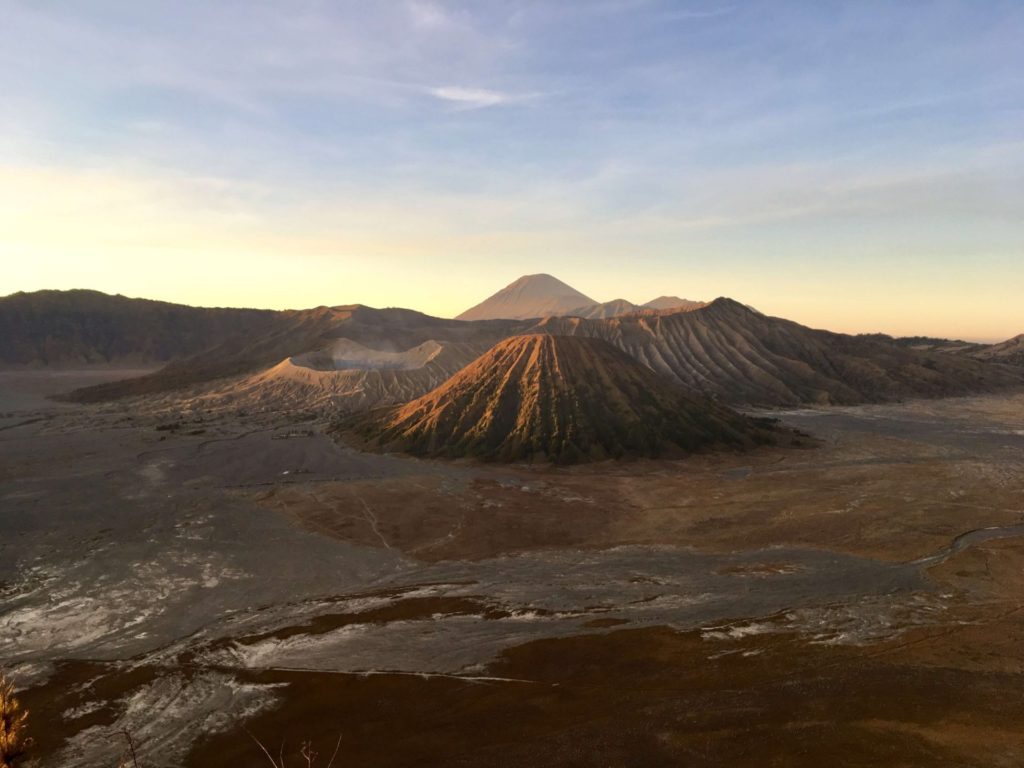
The five volcanoes within the caldera are surrounded by the impressive Sand Sea. It is as if you were walking over the moon. The landscape is desolate yet beautiful. A vast extension of fine volcanic sand with small plateaus that make you think of a different world. Outside the caldera we can find other mountains, such as Mount Penanjakan, an ideal viewpoint to see the sunrise and enjoy the whole caldera and Mount Semeru from a distance.
You might think that with so many volcanoes the temperature must be always hot. Well, let me remind you that the complex is found at a minimum height of 2200 (masl). Thus, temperature can get very cold at night and not super hot during the day. During out time there we were between 5º and 15º.
Hiking to Mount Bromo on your own
Once we left our stuff and got some food, we got ready for conquering yet another volcano. I forgot to mention that the girls had also been in Kawah Ijen. It seemed we were really adventurous volcanoes’ chasers. Hiking to Mount Bromo on your own shouldn’t be that hard. Or that’s what I thought after doing some research.
Route to Mount Bromo by foot
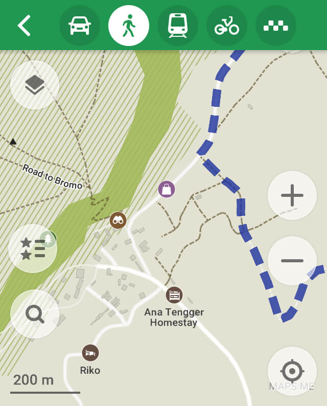
I had also read that we could run into some guards or locals asking for money. The thing is that quite some people would go to Mount Bromo on a jeep tour or by horse. I didn’t like either and I didn’t want to pay for any. Thus, I did my best to find a way to go there on my own, using my own legs. To that extend, for the first (but not last) time during my trip, I started using Maps.me. As long as you download the app and set “Mount Bromo” as your final destination, you shouldn’t have any problem. But, just in case, I will provide you with some useful screenshots 😉
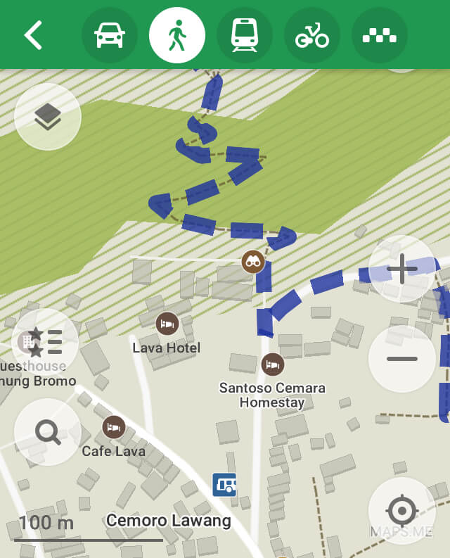
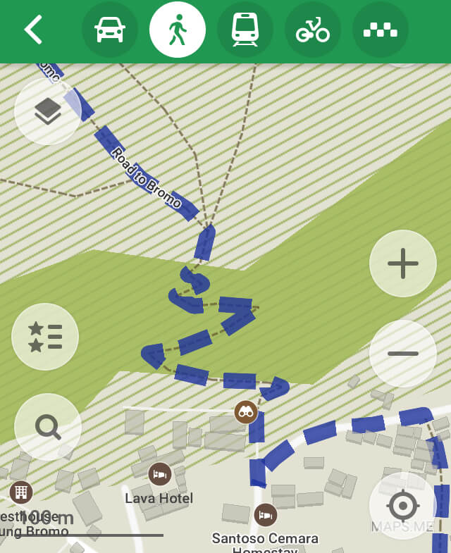
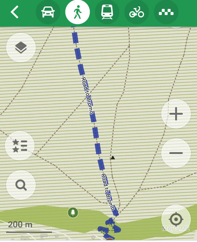
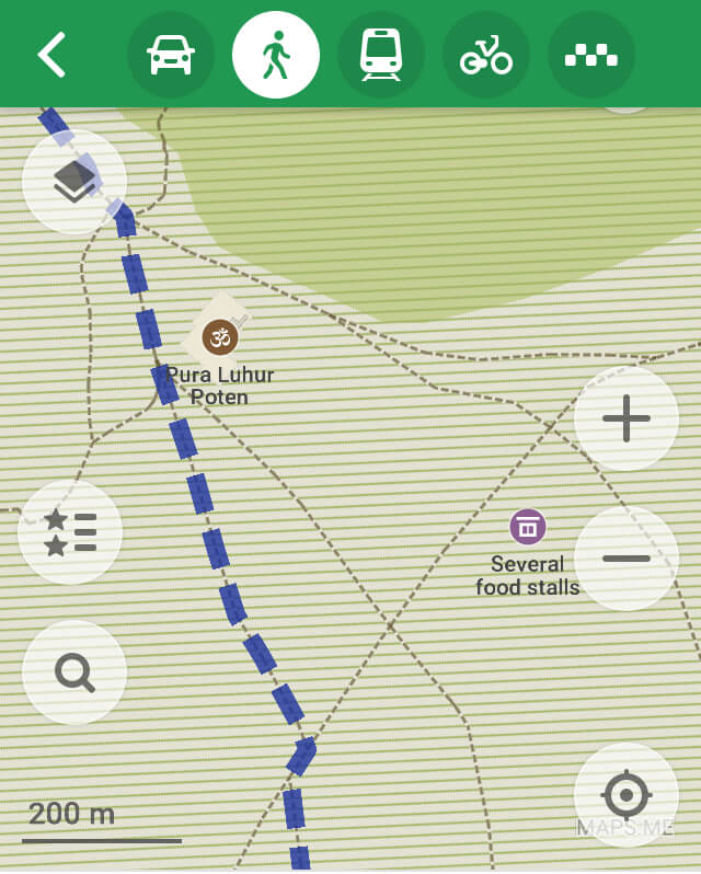
You might find a different route but that one worked just fine for us. Many people go see the sunrise in the morning. You have plenty of viewpoints, most of them on Mount Penanjakan (more info on this later). Then, on their way down, they make it to the Tengger Sand Sea and Mount Bromo. We discarded this option because we thought there would be a lot of people during the sunrise who might wanted to check Mount Bromo straight away. Instead, we divided the journey in two parts: Mount Bromo during the afternoon and sunrise facing Mount Bromo next day early in the morning. The result: we found almost no one during our hike to Mount Bromo.
According to Maps.me, the whole hike to Mount Bromo should take around 1 hour. I believe we did it in 45 minutes. We had just been hiking to a tougher volcano at night, what did you expect? Just kidding :).
After the zigzag through the vegetation, as soon as we stepped on the soil, we realised we were on the way to something different, something we hadn’t experienced before.
Welcome to the Tengger Sand Sea
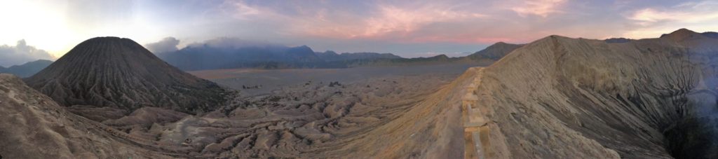
We had been walking for 5 minutes when the soil started to change. The small vegetation (like on the picture above) started to disappear. Little by little, we couldn’t see any sign of vegetation, but just black and brown sand. Now and then we would see some small plateaus, which, along with the sand and some small craters, made us think we were on the moon. We didn’t run into many people. We saw a couple of jeeps and some locals riding horses, but that was pretty much all.
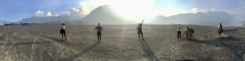
We had been walking for around 20 minutes and the path was really flat. I guess it’s no wonder, taking into account that we were within a huge caldera called “Sand Sea”. But, just in case, I wanted to point out that, compared to hiking Kawah Ijen, the level of difficulty and fitness is way lower.
Pura Luhur Poten
We started to see a temple from far away and, even if we didn’t stop, we knew we were getting closer to Pura Luhur Poten. Once you see it, leave it to your right and keep walking straight. You will be on the top of Mount Bromo soon. The temple, unlike most of the ones I had seen in Bali, was made of black rocks. In Bali, they are normally made of red bricks. Since Pura Luhur Poten is within the Tengger Sea Sand I guess it makes sense to have it built with the materials they had all around.

The temple is an Hindu one, which holds significant importance to the Tenggerese people scattered across the mountain villages. They organize annually what’s called the “Yadnya Kasada” ceremony, which lasts for about a month. During that ceremony, the crowd walks down to the crater of Mount Bromo and throw offerings inside.
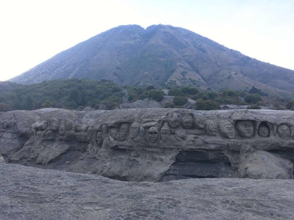
We left the temple to our right and kept on walking. We started to see a few tourists and we knew there was no way to miss Mount Bromo. The landscape started to change. It became more abrupt and cracks started to show up all around. In between, we saw plenty of Buddhas…
Stairway to Mount Bromo crater
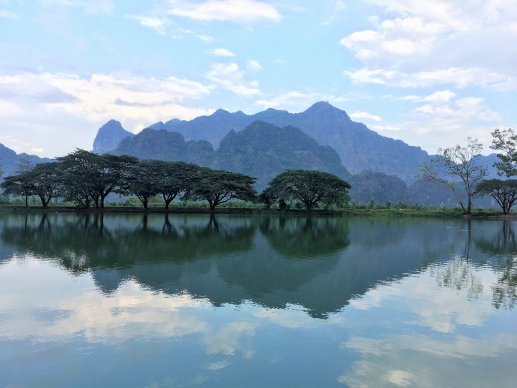
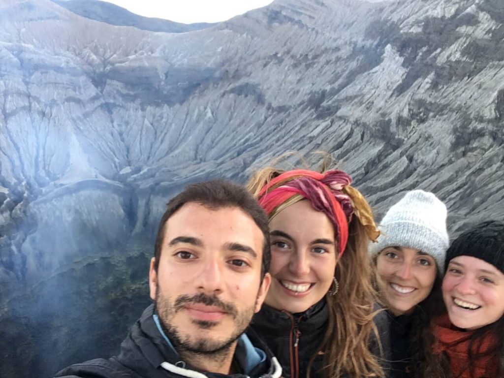
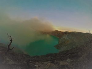
After the Buddha faces, we saw a sign pointing out the way to the crater of Mount Bromo. There were plenty of steps. That would be the hardest part to hiking Mount Bromo on your own. I decided to count the steps as I walked up to the crater. There were 240 in total. And, once I made it to the last one, I turned around and saw something like this:
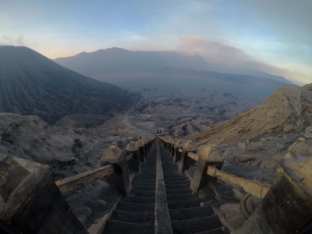
That was what we had left behind. An amazing out-of-this-world landscape. What we had in front of us though wasn’t bad either. I hadn’t heard a similar sound before except for the one that trains or airplanes make. I had that as a reference for the sound but, even if I had already been to Kawah Ijen’s crater, I had no reference whatsoever to what I was just seeing. How about you?
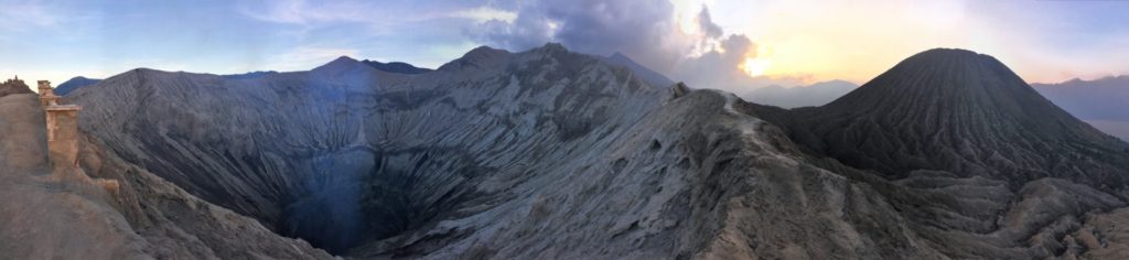
Mount Bromo as its best
It was both huge and impressive. It was spectacular and breathtaking.
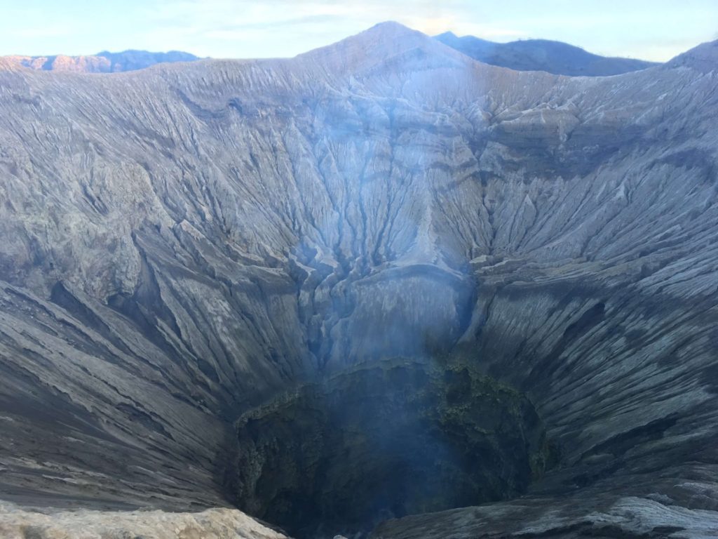
We walked around for a while, astonished at every step we took. The nightly hike to Kawah Ijen was a pretty interesting experience. The blue fire, even if we didn’t see much of it, was also remarkable. The same goes for the acid lake, whose silhouette we distinguished as the sun was rising. All in all, I had never experienced something like what I had in front of me. I had never experienced so much greatness and power in my life. I guess that, not knowing how to react to that, I did what I had been doing so far: spinning around.
The white smoke coming out of the crater was sulphur gas. It wasn’t as bad as at Kawah Ijen, but, it was still kind of annoying, specially for our eyes and breathing. All in all, you don’t need a mask, or, at least, we didn’t use any 🙂
The sun was setting and that started to make the landscape even more impressive. Regardless of where we looked at, we felt amazed. We felt like being part of another world. What do you think?
When we were getting ready to take the steps back down, some tourists came to the crater. After looking closer, I realised that, among them, there was the guy from Livia with whom I had hiked to Kawah Ijen. The world is indeed small for those who travel 🙂
Walk back to Cemorolawang under a starry sky
We chatted for a while and we ended up walking back to the village of Cemorolawang together. On the way, we met some more tourists. The night started to fell on us but we were almost there. We had to stop though… it wasn’t because we had a problem, but to start enjoying the stars and even planets we could see from there. It was amazing. I guess it was like looking at a starry sky from the desert, with no light pollution. We were so at ease with such a beautiful landscape that we stayed there for a while. Hadn’t it been so cold or had we had some warmer clothes, we had spent the night there.
After leaving the marvellous starry sky behind, we agreed upon meeting at Cafe Lava Hostel to have some food and drinks. One hour later we were all gathered there. We were around 10 people, most of us unknown to each other, but that didn’t matter much. We were all there for the same: enjoy mother nature as its best, being volcanoes, stars, sunsets or sunrises.
The place was super expensive. We ordered something but not like I had done back in some of the Warungs in Banyuwangi lol. After an hour or so, realising we were still hungry, we said good bye to our new friends and went to the Warung next door: Warung Satria. It was way cheaper and the food was also good. Backpacker’s life 😉
With our stomachs feeling better we walked back to our homestay and got ready for a few hours of sleep. Next morning, the alarm would be going off at 03:45. Next stop: watching the sunrise from Mount Penanjakan.
Watching the sunrise from Mount Penanjakan
As I was saying before, we set the alarm at 03:45 so we could start walking at 04:00. In your case, depending on the time of the year, you might want to check the time for the sunrise, so you make it to the viewpoint on time.
Like with hiking to Mount Bromo on your own, if you are using Maps.me (you should by now), you shouldn’t have a problem finding your way to the viewpoint. There are different options, depending on how high you want to go. In our case, we wanted to make it a little farther from King Kong Hill, so we could avoid the crowd and have a good spot. Just in case, I’ll provide you with a couple of screenshots 🙂
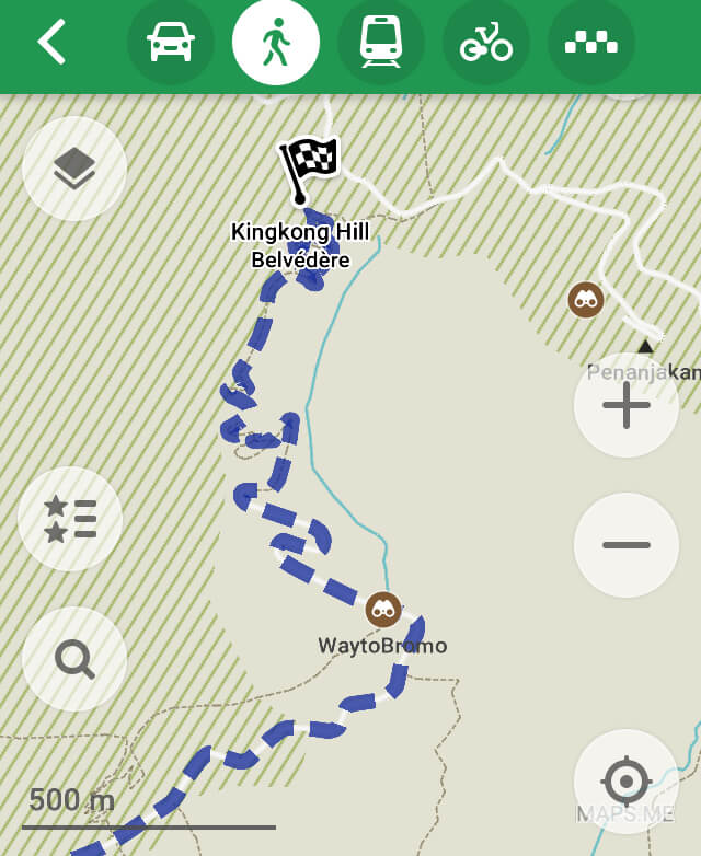
I didn’t find the hike tough or difficult, but it was steeper than hiking to Mount Bromo. The road was kind of good enough, although we didn’t see many people driving their vehicles. We didn’t run into a lot of people, but the few ones we run into were, like us, walking. There were a few booths along the way where the locals were selling food and drinks.
You don’t need anything special for the hike, other than water, a hoodie (it can get cold specially at that time of the day) and a flashlight. We walked and walked for around 45 minutes when we started to see people stopping. We had arrived to the first viewpoints but we decided to keep on going. Once we arrived to King Kong Hill, we kept on walking straight and, after 30 minutes or so, we finally stopped. I don’t remember the name of the viewpoint, I just know it was like 30 minutes away from King Kong Hill.
I’m not sure if there is a “best viewpoint”, but, for us, the one where we stopped at, was really good. Depending on how long you want to walk for, you will make it to “better” or “worse” viewpoints. But, in average, I would say that after an hour walking, you should make it to a good enough viewpoint. We didn’t see many people when we stopped, and the same went on during the time we spent there. I would say, in total, we were like 10 or 15 people there. We made it right on time for the sunrise. It was spectacular.
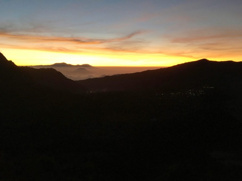
It was beautiful. Being there, surrounded by an speechless landscape. Watching the sun rising up, little by little, but yet without a pause. I know it might sound like a cliche, but I wonder why we don’t go watch the sunrise or the sunset more often. It is like if they were worth it just when being away from home, but it shouldn’t be like that. We should try to enjoy them now and then, for as long as we can.
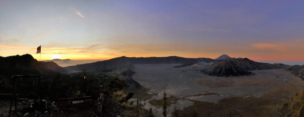
At this point you might be enjoying the sunrise pictures, but it might be that you are wondering: “wasn’t Mount Penanjakan the best spot to watch the sunrise over Mount Bromo”? Well, in a way. As you can see, the sun started rising from the west side of Mount Bromo. That being said, the views of Mount Bromo from Mount Penanjakan were just sublime. Take a look yourself. What do you think?
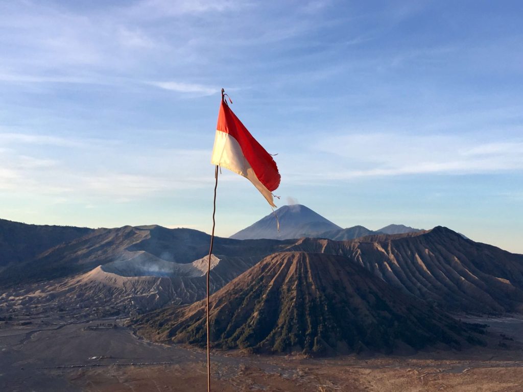
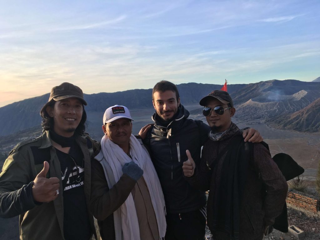
Amazing views, aren’t they? I even got this picture with some locals 🙂
It was around 07:00 when we started walking back. The sunrise had been amazing and the views from up there spectacular. Some hours before we had been on the top of Mount Bromo, and now, we had just been watching it from far away. The whole Tengger caldera looked astonishing. Again, mother nature as its best.
So long Cemorolawang!
Back in Cemorolawang, we went straight to Warung Satria to have some good and cheap breakfast. It felt really good after having been walking for a while. Once we felt satisfied, we walked back to the homestay, got our stuff and went outside, to a road where there was a mini van waiting to take people to Probolinggo bus terminal. I don’t remember the name of the street, but if you just ask around for the mini van going to Probolinggo, you shouldn’t have a problem.
Like we had done the first time we took the mini van from Probolinggo to Cemorolawang, we just waited until it was full, so we paid 35 K each. As we waited, I thought about the time we had spent in Cemorolawang. I was really happy I decided to go there. Hiking to Mount Bromo had been an amazing experience and I was glad we did it in our own. I wanted to provide you with this amazing website before finishing the post, I found it very useful (even if I just found about it recently lol).
https://en.wikivoyage.org/wiki/Bromo-Tengger-Semeru_National_Park
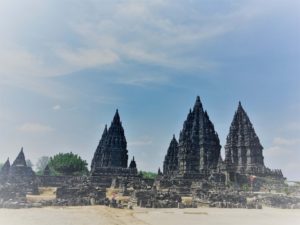
I had spoken with the girls and it seemed our paths would be still crossing for a while, at least with Mai and Conti. Our next stop was one of the most famous cities in Java. Our next stop was Yogyakarta 🙂
2 Responses
Question for you. Does it have sulfur smell when you hike Mount Bromo. I have asthma wondering it will cause the problem. Thank you.
I don’t remember that smell in Mount Bromo but in Mount Ijen, but I would double-check it just in case.